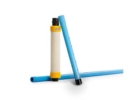
Descriptions
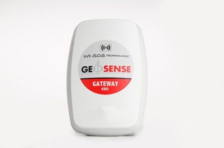
The LaserTilt90 is capable of transmitting data via long-range radio to a gateway connected to the Internet. One gateway can support hundreds of edge devices in the same network. These edge devices are also measuring other sensors installed in the monitoring sections (borehole extensometers. pressure cells. load cells. strain gauges etc.). lt can be easily configured and connected with a USB cable and an Android phone. The device network can also be easily managed through the Connectivity Management Tool.
Measurement of tunnel convergence is one of the most important controls of the NATM (New Austrian Tunneling Method) construction. Portable devices like tape extensometers, levels and temporarily installed total stations allow sporadic measurements. One of the most commonly used methods, the measuring tape, disrupts construction activities due to the use of aerial work platforms.
The LaserTilt90 may be easily relocated along the convergence cross sections up to the excavation front or until the measured relative displacements are stabilised when the required frequency of measurements is reduced. lt can also be used when permanent monitoring is required. The wireless sensor can also measure deformations in underground excavations and mining without causing work disruptions and delays.
Case Studies
M6 Junction 10
Walsall Council is working in partnership with Highways England to improve Junction 10 of the M6.
As a busy route between Walsall and Wolverhampton, the junction is often heavily congested. This impacts on local residents and businesses, and has reduced the attractiveness of the local area for investment, including the nearby Black Country Enterprise Zone.
Plans include the widening and redevelopment of two bridges and improvement of the junction.
Traffic management was required to access the locations and potential weather effects on the slopes could have made in-situ data reading difficult. As the piezometer installation was split across both sides of the carriageway, data download could also have been very time-consuming.
Selection of a wireless system avoided any impact from these site-specific problems. The client was impressed with the range of the system even when the nodes were housed inside locked upright security covers.
M6 Junction 10 Case Study
Mersey Gateway Project
The Mersey Gateway brings much-needed traffic relief for the existing Silver Jubilee Bridge and leads the infrastructure investments required to deliver regeneration of Halton and the North West.
More than 80,000 vehicles use the Silver Jubilee Bridge every weekday – ten times the number it was originally designed for. This extra traffic puts the congested and ageing Silver Jubilee Bridge and the resilience of the regional road network under severe pressure.
The new bridge is designed to carry up to six traffic lanes forming part of a new and improved high standard road (9.5km long) connecting north Widnes and Merseyside with Runcorn and the national motorway network in north Cheshire.
The design of the new Mersey Gateway Bridge is based on a cable-stay structure similar to the second Severn Crossing, but with three towers. It will be 2.3km long with a river span of 1km. The main bridge deck will be made from reinforced concrete and the spans will be supported by steel cable stay.
Mersey Gateway Project Case Study
River Humber Gas Pipeline Replacement Project
Work has been carried out on a £100m project to create a tunnel under the River Humber to carry one fifth of the UK’s gas supply to millions of homes.
The three-mile tunnel houses a new gas pipeline running between Goxhill in North Lincolnshire and Paull in East Yorkshire and was expected to take a year to build. National Grid needed to replace the current pipeline, which is in a trench just below the river bed and is at risk of being exposed by the tides.
The crown of the TBM passed 7m underneath an existing in-service gas pipe, approximately 10” in diameter and a few hundred meters from the reception shaft on the Paull side. On this existing gas pipe in-service, three spots were monitored for changes in strain as the pipe falls in the zone of influence of the TBM.
River Humber Gas Pipeline Replacement Project Case Study


